Engineering Surveys
Topographic Surveys
Topographic Surveys which aim to gather survey data about the natural and man-made features of the land, as well as its elevations.
As-Built Surveys (or Structural/Facilities/Utilities Surveys)
As-Built Surveys refers to the survey of man-made features and structures such as buildings, utilities and facilities in a particular site or parcel of land.
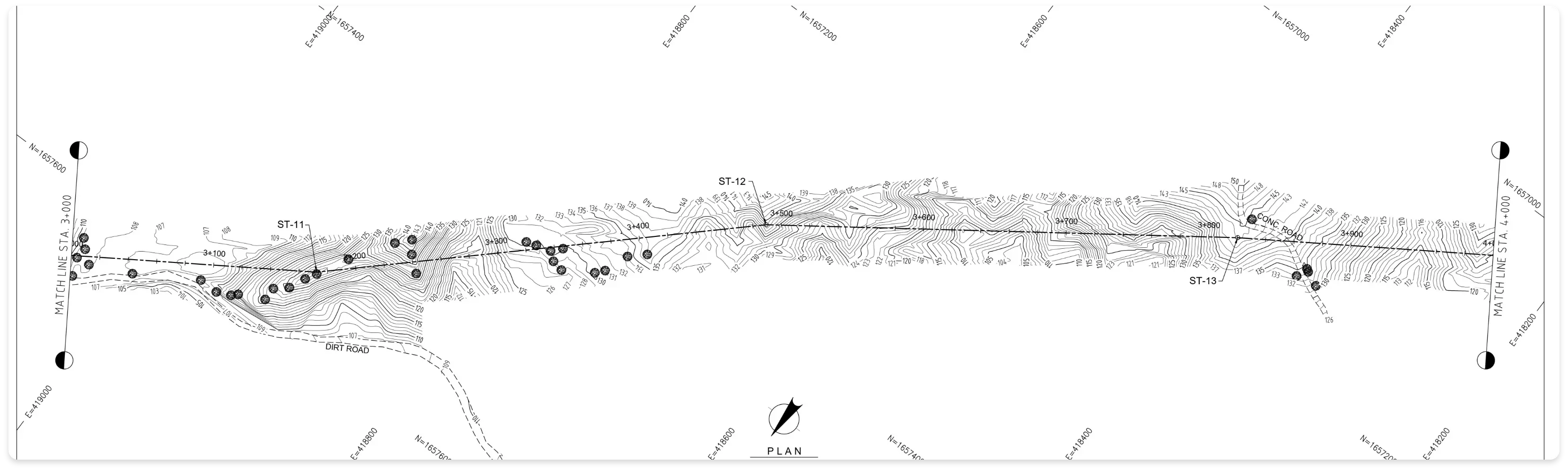
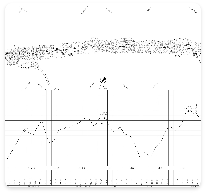
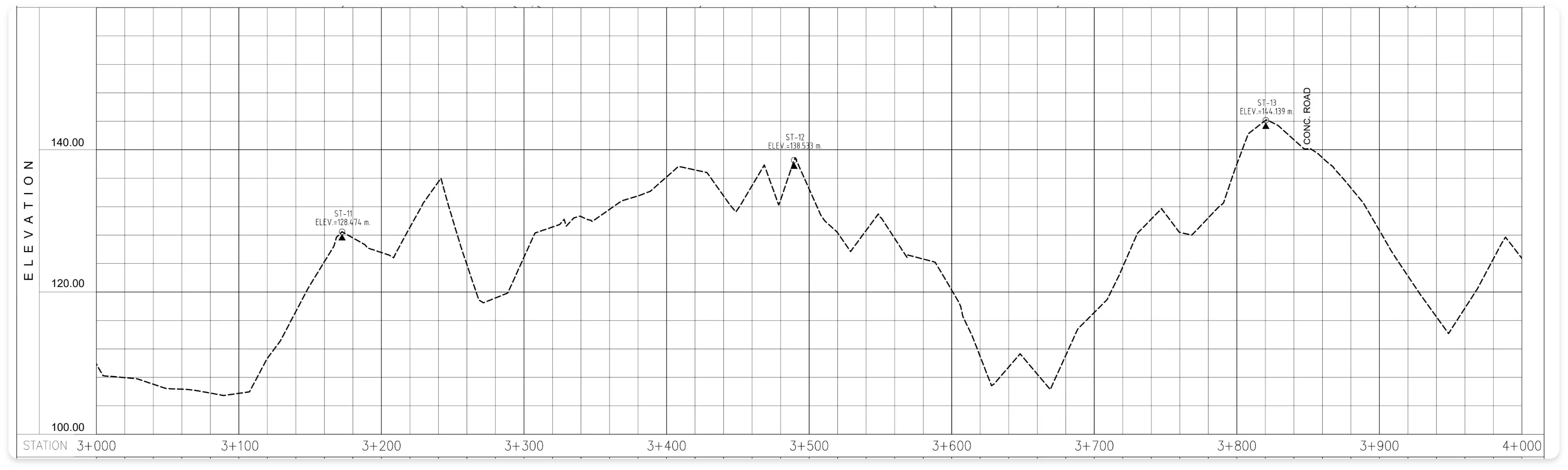
Route Surveys (for Roads, Pipelines, Railways, Transmission Lines, Rivers & Creeks)
Route Surveys refer to the surveys for establishment of roads; identification of lots affected by road constructions and/or other horizontal developments; and as well as conduct of profile and cross sections surveys.
Tree Tagging Surveys
Tree Tagging Surveys are field surveys to locate all trees within the property. Details of tagged trees includes height, canopy, caliper, specie name, and quantity.
Staking of Borehole Points & Test Pits
Staking of Borehole Points & Test Pits are field survey to locate and marked the location of Boreholes and Test Pits that will serve as guide to the drilling team. The location of the points should be identified by a Geotechnical or Structural Engineer.
Bathymetric Surveys
Bathymetric Surveys are sometimes referred to as a Fathometric Survey, is a type of hydrographic (water-based) survey that maps the depths and shapes of underwater terrain to illustrate the land that lies below.
Volumetric Surveys
Volumetric Surveys are the comparisons of the results of two or more topographical surveys conducted at different points in time.
LiDAR/Drone Surveys
LiDAR/Drone Surveys stand for Light Detection and Ranging. It is a surveying method that measures the distance to a target by illuminating the target with pulsed laser light and measuring the reflected pulses with a sensor. It is commonly used for areas with security issues. Instead of doing fieldwork in dangerous locations or situations, people can use LiDAR to collect data at a safer and distant location.
Survey Retainership
Survey Retainership holds paramount importance throughout the construction life cycle. Our approach entails unwavering adherence to national technical standards, ensuring the seamless execution of all required surveys. Throughout the project, you can rely on ACCSS to furnish the necessary technical expertise, cutting-edge survey tools, equipment, and dedicated supervision, guaranteeing optimal outcomes.
Delve into our portfolio showcasing our list of completed projects and the vast experience we bring to the table.
Do you have a project we can help with? Send us an inquiry or request a quotation with us today!