Quality Land Surveying Solutions Within Reach

Providing the quality PROPERTY & ENGINEERING survey services for our clients since 2021.

Quality Land Surveying Solutions Within Reach

Providing the quality PROPERTY & ENGINEERING survey services for our clients since 2021.

Quality Land Surveying Solutions Within Reach

Providing the quality PROPERTY & ENGINEERING survey services for our clients since 2021.

Quality Land Surveying Solutions Within Reach

Providing the quality PROPERTY & ENGINEERING survey services for our clients since 2021.

Quality Land Surveying Solutions Within Reach

Providing the quality PROPERTY & ENGINEERING survey services for our clients since 2021.

Property Surveys
Engineering Surveys
Free Consultation

Our Core Values

Accurate & Reliable
Surveys

ACCSS ensures that every client receives the quality survey solutions on every project engagement.

Competitive Survey
Rates

ACCSS leverage its expertise in land surveying to provide the most cost-effective solutions.

Fast & Innovative
Solutions

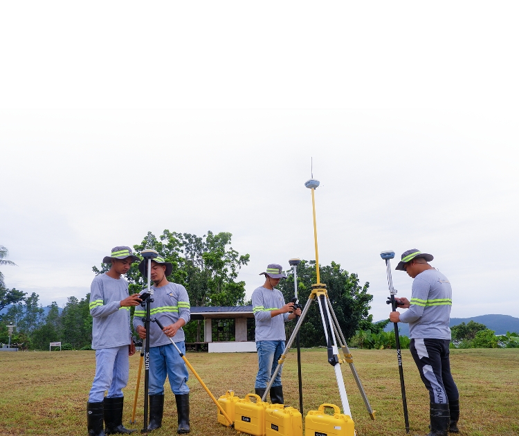
ACCSS supports its survey teams with state-of-the-art survey equipment and effective project tools.

Customer Service
Oriented

No project is too big or too small. ACCSS is confident of its capacity to swiftly mobilize in every project and finished technical plans to meet the client demands.

Industries We Serve

CONSTRUCTION
LAND DEVELOPMENT
RENEWABLE ENERGY
MINING

Full-Service Land Surveying Services

We provide land survey solutions to individual and corporate enterprise.

Property Surveys

Boundary/Relocation Surveys refer to the relocation of corners or re-setting of boundary lines of approved surveys shall be made using the bearings, distances, and the area stated in the approved survey or written in the lease contract, if any, or Torrens Title.

Original Surveys refers for the survey of land for the purpose of public land application for Homestead, Free Patent, Sales, and other modes of disposition under CA 141, as amended, otherwise known as the Public Land Act.

Re-Surveys are surveys made on approved survey for purposes of establishing the technical description of approved survey which is missing as certified by LMB and LMS office concerned.

Verification Surveys are surveys ordered by The Regional Technical Director for Lands whenever any approved survey is reported to be erroneous, or when titled lands are reported to overlap or where occupancy is reported to encroach another property.

Simple: Subdivisions of land with area less than one hectare; where roads are not required to be delineated, not necessarily to be developed and open spaces are optional.

Complex: Subdivision of a registered land pursuant to BP-220 and PD-957, as amended. Land development is required for land with area greater than one (1) hectare which includes roads, passageways and open spaces such as parks.

Agricultural: A simple subdivisions of mostly large tract of public and/or private land (more than one hectare) for the purpose of farming and other agricultural purposes.

Institutional: Complex Subdivision of land for education, government housing and other institutional uses or purposes.

Engineering Surveys

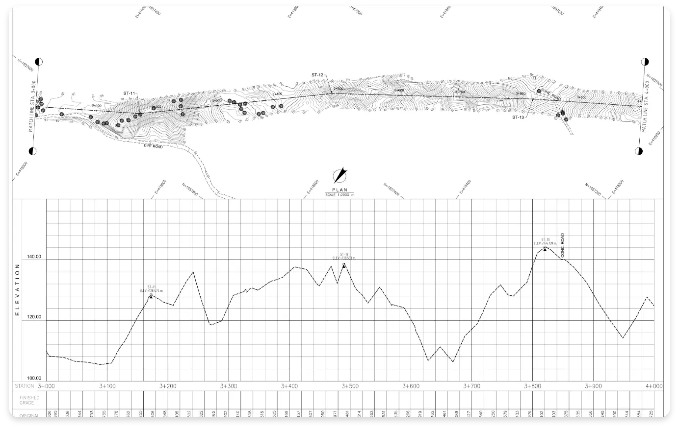
Topographic Surveys which aim to gather survey data about the natural and man-made features of the land, as well as its elevations.

Topographic Surveys which aim to gather survey data about the natural and man-made features of the land, as well as its elevations.

Route Surveys refer to the surveys for establishment of roads; identification of lots affected by road constructions and/or other horizontal developments; and as well as conduct of profile and cross sections surveys.

Tree Tagging Surveys are field surveys to locate all trees within the property. Details of tagged trees includes height, canopy, caliper, specie name, and quantity.

Staking of Borehole Points & Test Pits are field survey to locate and marked the location of Boreholes and Test Pits that will serve as guide to the drilling team. The location of the points should be identified by a Geotechnical or Structural Engineer.

Bathymetric Surveys are sometimes referred to as a Fathometric Survey, is a type of hydrographic (water-based) survey that maps the depths and shapes of underwater terrain to illustrate the land that lies below.

Volumetric Surveys are the comparisons of the results of two or more topographical surveys conducted at different points in time.

LiDAR/Drone Surveys stand for Light Detection and Ranging. It is a surveying method that measures the distance to a target by illuminating the target with pulsed laser light and measuring the reflected pulses with a sensor. It is commonly used for areas with security issues. Instead of doing fieldwork in dangerous locations or situations, people can use LiDAR to collect data at a safer and distant location.

Survey Retainership holds paramount importance throughout the construction life cycle. Our approach entails unwavering adherence to national technical standards, ensuring the seamless execution of all required surveys. Throughout the project, you can rely on ACCSS to furnish the necessary technical expertise, cutting-edge survey tools, equipment, and dedicated supervision, guaranteeing optimal outcomes.

Optimizing Project Timelines and Maximizing Budget for Your Benefit

State-of-the-art surveying equipment, resources, and skilled personnel

51-Hectare Topographic & LiDAR Survey Project for Geological Mapping
116-Hectare Topographic Survey Project for 60MWP Solar Power Plant
Staking of 70 Borehole Points (Offshore) for Geotechnical Study
17-Hectare Topographic Survey for Commercial Development of Cabuyao

Successfully Completed Survey Projects Nationwide

Begin Your Project
With Reliable Mapping

Do you have a project we can help with? Send us an inquiry or request a quotation with us today!